You may no longer be able to use Keyhole.

This is to inform those of you who have been using Google Earth since it was Keyhole about a change in service.

We'd like to thank you for being such loyal customers and following us as we've grown throughout the years, but now it is time to say goodbye to the classic Keyhole application that we've all known and loved. There have been many improvements and new features since we have become Google Earth such as 3D models and overall faster performance. So please upgrade to the latest version to continue enjoying your globetrotting adventures without interruption.

All of our efforts will be focused on making Google Earth the best mapping experience on the planet.


Google Earth 5.0 Street View (Free)

Google Inc.
1600 Amphitheatre Parkway
Mountain View, CA 94043

Google Maps Street View (Online)

Google Inc.
1600 Amphitheatre Parkway
Mountain View, CA 94043

Google Earth for Mac (Free)

< Astronomy and Map Programs >

Keyhole is now Google Earth (Free)
Keyhole 2 NV 2.2.99 ...3D Satellite Earth Viewer

Home/Personal Use – Fly For Fun. Fly To Be Informed. (NVIDIA graphics cards only)

Keyhole 2 NV is a software application that you download and install. It's only 4MB, but with a Keyhole subscription (monthly or annual), you can fly through 7+ Terabytes of Earth imagery and data – spinning, rotating, tilting, and zooming. And now you can switch planets and explore Mars as well!

Mars
Earth
Earth

Keyhole 2 Pro Is now Google Earth Pro

Keyhole 2 LT 2.2.99 ...3D Satellite Earth Viewer

Keyhole 2 Pro

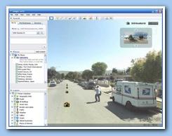
Keyhole 2 PRO puts the earth on your desktop. Our patent-pending technology enables you to point and fly to hundreds of US and international cities. Zoom down to detail showing individual buildings, search for existing businesses by name or category, even fly to a specific address.

And now, with Keyhole 2, you can easily import lists of buildings, overlays showing demographic trends, proposed developments, and even site plans. The powerful XML-based collaboration capability in Keyhole 2 allows you to share lists of locations, with custom icons and detailed descriptions, with a single click. Keyhole's streaming technology does the heavy lifting, putting your data in the context of detailed imagery, 3D terrain, and map data.

Accelerate Location Intelligence and Collaboration

  • Become an instant site expert without costly, time-consuming site visits
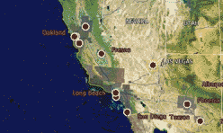
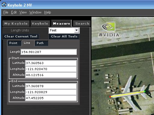
  • Turn on dozens of bundled data layers – businesses, hotels, restaurants, city boundaries, traffic counts*, shopping center locations. Measure distances, lots and buildings. All with the complete freedom to fly to any view with amazing speed.
  • Locations and overlays can be grouped into a single folder and sent with a single click to colleagues across the office or across the country.

Elevate Your Marketing -- Keyhole 2 PRO is a must-have for anyone marketing or presenting location information

  • Customize the view with your own data, including custom icons, logos, and image overlays (such as JPGs of your site plans)
  • Use Keyhole 2 PRO to create graphically rich marketing documents, presentations, and even website animations

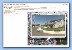
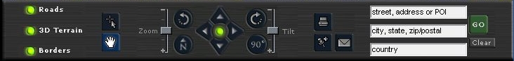
Type an address and instantly fly to over 9 Terabytes of imagery. Easily save an aerial view as a JPG snapshot for use in marketing literature, or print directly from the application.

New Premium Data and Features -- build a solution 
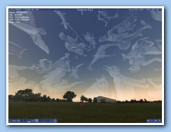
tailored for your needs Create captivating, fluid animations that make your point with power and clarity.

Users can now easily integrate geographic data, manipulate it, and share it among co-workers.

ESRI SHP, Mapinfo TAB, DGN, Geotiffs, Geocoded CSV Spreadsheets

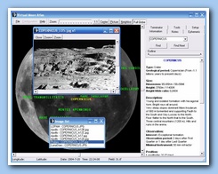
Easily produce compressed, fluid animations of your flyovers using the new Movie Maker module. Save on CD-ROM or publish to the web.

Export movies in .WMV or .AVI format

Premium Printing – Print images of up to 3000 x 2000 pixels for stunning clarity.

Print up to 11 x 17 images.

Keyhole 2 NV...EarthViewer 3D NV

Home/Personal Use – Fly For Fun. Fly To Be Informed. (NVIDIA graphics cards only)

Keyhole 2 NV is a software application that you download and install. It’s only 9MB, but with a Keyhole subscription (monthly or annual), you can fly through 7+ Terabytes of Earth imagery and data – spinning, rotating, tilting, and zooming. Think magic carpet ride.

Keyhole 2 NV (Beta) is now available for download. Some major changes have been made in this new release - this is our best software yet!

Keyhole 2 NV Features:

  • Measure distance between points, or of a path. (How far did you run? How long of a trip is it? Is a new apartment within a mile of the train station?) Click here to view screen shot.
  • Rotate imported overlay images in the Keyhole application.
  • New modular interface.
  • Toggle over to full screen mode.
  • Create and Share Keyhole KML – An entire folder of Placemarks can be shared among other Keyhole members through email or the BBS. With these Placemarks, you can create your own descriptions that can be shared as well. Click here to view screen shot.
  • Access more imagery and geographic data than ever before (check out the updated coverage list ).

Keyhole 2 LT

Home/Personal Use – Fly For Fun. Fly To Be Informed.

Common uses of Keyhole 2 LT include:

  • Finding a new home
    Take a virtual tour of the neighborhood, see the locations of schools, shopping and transportation, identify the tax district, and get crime statistics. With Keyhole 2 LT's powerful 3D visualization capability, you can even evaluate the view!
  • Outdoor activities
    Choose the best mountain bike trail, find the perfect camping location, or pick a hiking destination. Keyhole 2 LT even lets you view terrain of your campsite in 3D!
  • Sporting and recreation
    Identify fishing spots, map out a hunting expedition, or pick a golf course. Thanks to the Keyhole 2 LT overlay function, you can even consider the weather forecast in your decision!
  • Travel
    Plan your itinerary and find the perfect place to stay. See if that beachfront condo is truly on the beach!

       * not all cities in high resolution. See our coverage list .

New in Keyhole 2 LT!

  • NEW! Measure distance between points, or of a path. (How far did you run? How long of a trip is it? Is a new apartment within a mile of the train station?) Screen shot >>
  • Import overlay images and rotate it into the right position. Screen shot >>
  • New modular interface – toggle over to full screen mode.
  • Create and Share whole folders of map points of interest with Keyhole KML.
    Screen shot >>
  • Access more imagery and geographic data than ever before (check out the updated coverage list ).


With Keyhole 2 LT on your desktop, you can see if a vacation destination really is beachfront, where the nearest schools are to a new house, or just fly to hotspots in the news (check bbs.keyhole.com for hundreds of interesting viewpoints shared by Keyhole users).

Solar System Simulation Free

Jump To Astronomy and Map Programs Top of Page